Driver's Guide
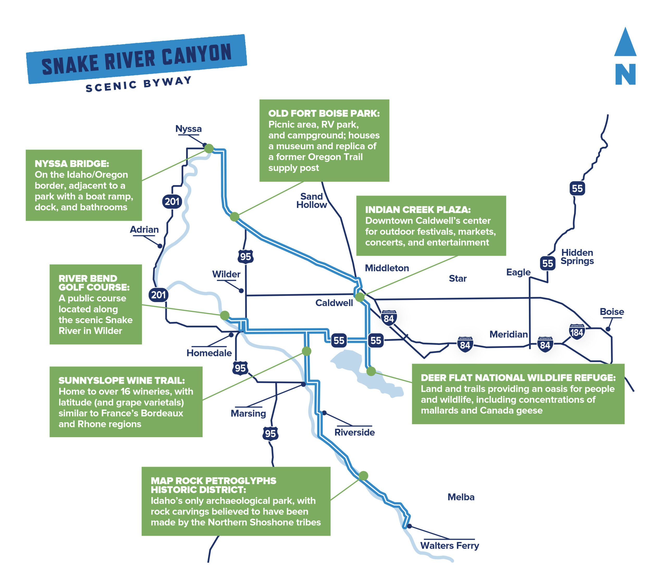
Snake River Canyon Scenic Byway
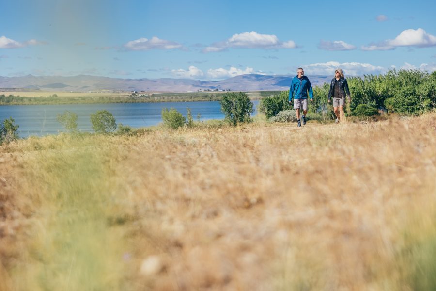
Get your binoculars, golf clubs, and taste buds ready. This scenic route offers delight for every appetite, from outdoor aficionados to wine enthusiasts.
Choose your own adventure as you meander along the Snake River Canyon and its many rolling vineyards.
Travel Details
Distance: 53 miles
Time: 1.5 hours, but allow more time for visiting historical sites and wineries along the route.
When to visit: year-round, but some canyon overlooks may be closed during winter months.
Highlights: scenic vistas, striking agricultural landscapes, Map Rock, Sunnyslope Wine Trail.
Services: gas, food, and lodging available in Nampa and Caldwell, and partial services in smaller towns.
Accommodations: available in Nampa and Caldwell, although the route is only a short distance from Boise and Meridian.
Getting here: You’ll start the trek on Idaho Highway 45, roughly 16 miles south of Nampa in Walters Ferry, and end at the Nyssa Bridge on the Idaho/Oregon border. Much of the route is paved, though you may find some gravel roads if you choose to explore wine country.
Local’s Tip: September and October are harvest months at many wineries, so there are plenty of opportunities on this route for fall activities like grape stomping and tasting new releases (not to mention, perfect weather).
Before beginning your route, consider a detour to the Morley Nelson Snake River Birds of Prey National Conservation Area, a 30-minute drive southeast of Walters Ferry. This area is home to the densest population of nesting birds of prey in North America, so you’re likely to spot raptors like the prairie falcon and golden eagle.
Begin the drive from the Snake River in Walters Ferry, proceeding north for about a mile. Take a left on Map Rock Road, and follow it for 7.3 miles, or about 15 minutes, until you reach the Map Rock Petroglyphs Historic District. Here you’ll find ancient carvings on a large basalt rock on the right side of the road and unique geological formations in the area.
These petroglyphs are believed to be a map of the Snake River Valley, drawn by Northern Shoshone Natives before the 19th century. Roadside parking is limited, so use caution when exiting your vehicle and exploring the terrain.
Continue on Map Rock Road until you reach Deer Flat Road. Take a left and follow the road for just over a quarter of a mile, then take a right on Chicken Dinner Road. Proceed for three miles until you reach Sunny Slope Road/Marsing Road. We recommend making a couple of stops along the Sunnyslope Wine Trail and tasting the fruit of the local terroir. This region is part of the Snake River American Viticultural Area (AVA) and includes over 16 wineries and vineyards. Cheers to that!
Scenic Byways
Get out and go. Southwest Idaho’s scenic byways (both official and unofficial) make for unforgettable road trips.
Explore AllIf you’re hankering for a few hours on the green, continue driving northwest to River Bend Golf Course in Wilder. Swing your clubs at this public, 18-hole course with several holes located along the Snake River, which is well worth a stop for its picturesque views and relaxed pace.
Or, for an alternate natural respite, head east on Idaho Highway 55 for about ten miles and stretch your legs at Deer Flat National Wildlife Refuge. This area offers over ten miles of trails and plenty of opportunities for spotting nesting birds and other wildlife around Lake Lowell.
Next, drive about eight miles north on South Indiana Ave. to Indian Creek Plaza, where a once-buried waterway has been revitalized as a vibrant part of Downtown Caldwell. There are plenty of dining and shopping options available, and depending on the day and the season, you might find a pop-up market, musical performances, or a winter wonderland complete with an ice skating rink and over a million Christmas lights.
Continue northwest via US-20 for about 16 miles to arrive in Parma. Here you’ll find Old Fort Boise Park, where you can tour a museum and see a replica of the original, which once served as a supply post along the Oregon Trail.
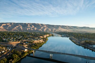
Travel just another eight miles north on US-20 and you’ll reach the end of the route at the Nyssa Bridge. As the day winds down, park here and cast a line into the Snake River. This is a terrific location for catching both a spectacular sunset and perhaps a few catfish.
Read More
-

Ultimate SW Idaho Summer Road Trip
We’ve put together the ultimate 10-day summer road trip through the most awe-inspiring and action-packed places in Southwest Idaho.
-
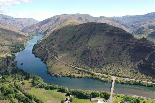
Hells Canyon Scenic Byway
If wild and rugged is what you're after, this remote scenic drive definitely delivers. There’s a reason Hells Canyon is such a popular bucket list destination.
-
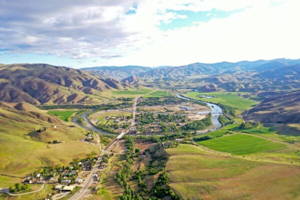
Lower Payette River Heritage Byway
This scenic route is rich in Idaho history and natural wonders, from museums and fruit farms to wildlife and hot springs.