Driver’s Guide
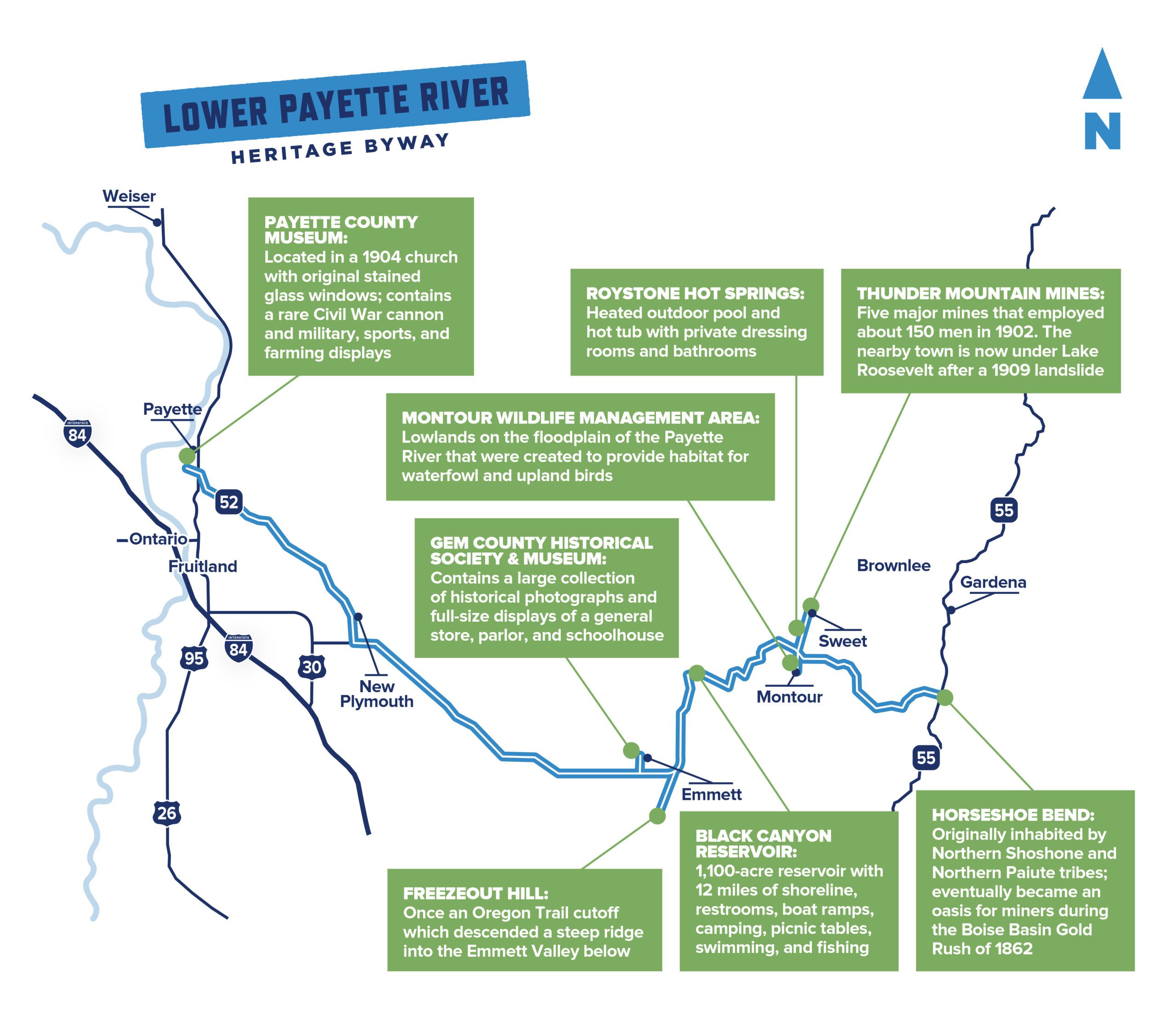
Lower Payette River Heritage Byway
This scenic route is rich in Idaho history and natural wonders, from museums and fruit farms to wildlife and hot springs.
For history buffs and nature lovers alike, this road trip offers something for everyone.
Travel Details
Distance: 57 miles
Time: 1.25 hours, but allow additional time for fruit picking, visiting outdoor recreation sites, and exploring museums.
When to visit: year-round, although some wildlife areas are closed from February to July to protect nesting birds.
Highlights: river views, museums, orchards and fruit farms, natural hot springs, Montour Wildlife Management Area, Black Canyon Reservoir and Dam.
Services: gas, food, and lodging available in Payette and Emmett, and partial services in Horseshoe Bend.
Accommodations: available in Payette and Emmett, though the route is only a short distance from Boise and Meridian.
Getting here: This route is paved and winds along the Lower Payette River through several charming Idaho towns, all long on history and hospitality.
Local’s Tip: Fruit-picking season is a great time of year to explore this route, as local u-pick farms open their orchards’ gates to the public from June to October.
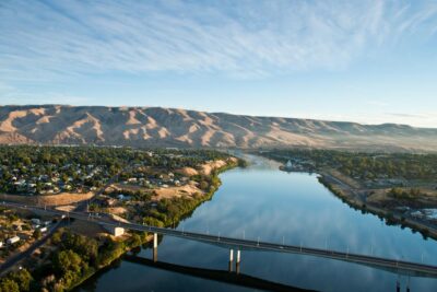
Begin your journey on the banks of the Snake River in Payette, Idaho. Make a first stop at the Payette County Museum, housed in a 1904 church replete with stained glass windows donated by early members. You’ll also glimpse one of the rarest surviving Civil War cannons, along with other military, sports, and farming displays.
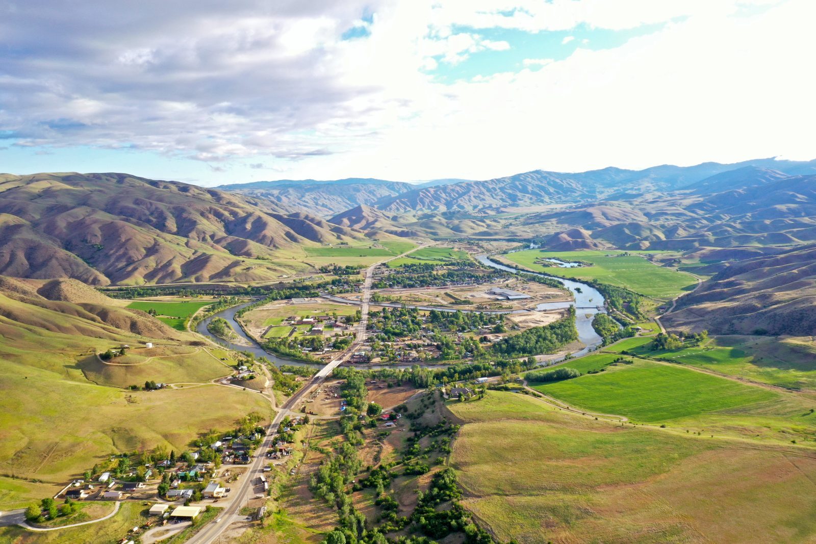
Head southeast on Idaho Highway 52 for approximately 30 miles until you reach Emmett. The town was originally built around an important ferry site and is now known for its fruit production. Depending on the time of year, plan to visit one of many orchards and u-pick farms, and savor the simple pleasure of harvesting your own ripe cherries, berries, apricots, nectarines, peaches, and apples.
While in town, step back in time at the Gem County Historical Society and Museum, where you can peruse the large collection of photographs documenting local history, from the Native Americans to the area’s early trappers, miners, and settlers. The museum also features full-size displays of a general store, parlor, and single-room schoolhouse.
Follow Idaho Highway 16 south for about three miles, until you reach Freezeout Hill. Here, settlers attempted to enter the Emmett Valley down the steep terrain. On one frigid night during the winter of 1864, early freighters were unable to descend the steep terrain and camped at the top of the hill. They nearly froze to death but eventually reached the bottom the next morning — and thus the name of this tough hill came to be.
Resume your journey east on Idaho Highway 52 for about seven miles until you reach Black Canyon Diversion Dam. Just above the dam is Black Canyon Reservoir, with three parks along the 12 miles of shoreline that offer picnicking, fishing, swimming, and water sports opportunities.
Scenic Byways
Get out and go. Southwest Idaho’s scenic byways (both official and unofficial) make for unforgettable road trips.
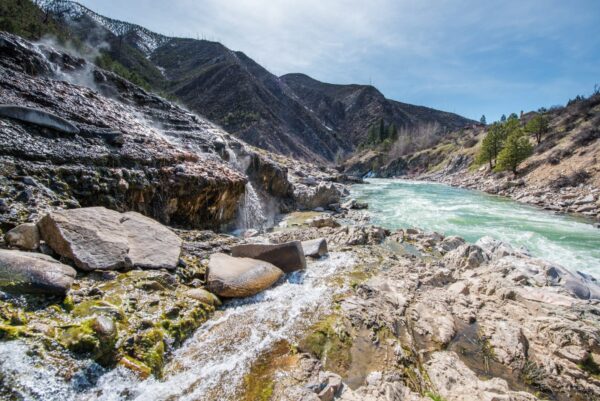
Explore AllSix miles past the dam, Roystone Hot Springs will be on your left. Take a quick dip in the natural hot springs pool, open year-round (with water temperature adjusted accordingly). Native Americans once wintered here, using the hot springs for warmth and mud bathing in nearby steam huts. Later, an early settler began a fruit and vegetable farm on the site, and it was eventually developed as a summer resort and health spa. The hot springs are now available to the public, with reservations required.
About a mile further on Idaho Highway 52, turn right onto Montour Road. Cross the river and you’ve arrived at Montour Wildlife Management Area. This 1100-acre lowland habitat is ideal for bird watching and spotting wildlife such as mule deer, coyotes, and minks.
Head back across the highway to visit the rural town of Sweet, about two miles north. Sweet once served as a freighter’s supply station to the nearby Thunder Mountain Mines during the gold rush. If you’re in the mood to wine and dine, Anderson Reserve houses a restaurant, bar, and market, run by a family of butchers with a long history in the trade of meat cutting.
Continue on Idaho Highway 52 for nine miles to end your journey in Horseshoe Bend. Pick up a fresh homemade pie from Volcanic Farms, and unwind on the Locking Horns Riverside Restaurant patio, where you might spot one of the area’s nesting bald eagles flying overhead.
Read More
-

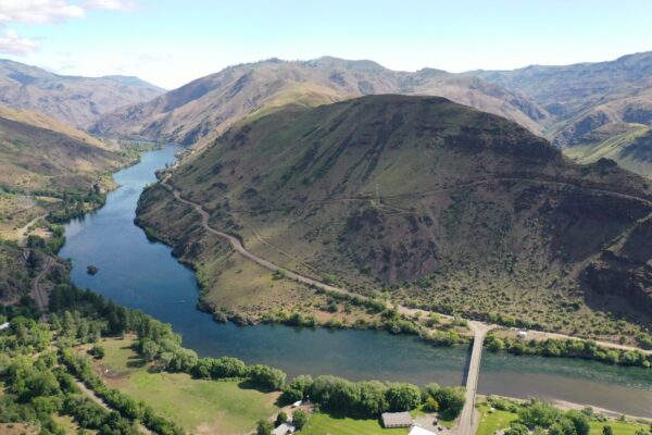
Wildlife Canyon Scenic Byway
The Wildlife Canyon Scenic Byway (Idaho Highway 17) is a great way to take in views of Southwest Idaho’s rugged scenery and the wildlife that call it home.
-
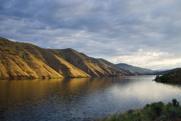
Hells Canyon Scenic Byway
If wild and rugged is what you're after, this remote scenic drive definitely delivers. There’s a reason Hells Canyon is such a popular bucket list destination.
-
HWY 95 Guide
Stretching from the Owyhee mountains to the depths of Hells Canyon, Hwy 95 takes you through some of the most picturesque places in Southwest Idaho.