Southwest Idaho has some of the most varied terrain on the planet. You name it, we’ve got it.
Deserts. Mountains. Forests. Lakes and rivers. Snow and sand. There’s something here for everyone. Artists, animal lovers, dreamers, adventurous families, and hardcore hikers — we will lead you to the perfect hiking spot and then to a place to rest at the end of a full day of adventure.
Be Safe, Be Courteous
- Never hike alone. Short and well-populated trails are one thing, but if there’s no easy access to emergency services, don’t go solo. Chances are good you won’t have cell service.
- Be prepared. Sunscreen, suitable footwear, layers, water, and snacks are the basics.
- Do your homework. Check out trail conditions, weather, and fire season rules before you head out.
- Know your limits. When choosing a trail, take your experience level, familiarity with the terrain, and fitness level into account.
- Respect nature. Stay on the path, and don’t hike in muddy conditions (you’ll contribute to erosion). Leave the flora and fauna alone. Pack out what you pack in.
- Respect nature. Outdoorsy Idahoans are famous for their friendliness. Keep the tradition alive.
For The Adventurous Family

Photo Credit: Idaho Tourism
Who You Are
Your hikes are all about the kids. Exercise, exploration, play — you’re ready to make memories.
Where to Go
Jump Creek Falls, Marsing
Pack a picnic and hit the road. This popular family hike features an easy trail with a big payoff — a waterfall that cascades into a beautiful swimming hole. A large portion of the trail is shady even in the height of summer. The rocky cliffs and caves will kick any kid’s imagination into overdrive.
Length: .6 mi.
Difficulty: Easy
Location: From Marsing, head west on Hwy 55. Take a left onto S. Jump Creek Rd. and continue for about 6 mi.
When to go: Visit in the summer when it’s warm enough to swim. Accessible March – October.
Goose Creek Falls, McCall
Goose Creek Falls is a great hike for older kids (or parents with a child carrier backpack and strong legs). This hilly trail roams through a pine forest and beside a fast-moving stream. It ends at a spectacular waterfall.
Length: 3 mi.
Difficulty: Intermediate
Location: From McCall, follow Hwy. 55 north for 4 miles. Turn right on Brundage Mountain Rd. and continue for 3 mi. Turn left at the sign.
When to go: Visit in late July or early August to score some huckleberries. Accessible March – October.
Charcoal Gulch, Idaho City
Just five minutes from Idaho City, this relatively flat hike is a perfect family outing. The pine trees provide shade in summer, and you’ll see many species of wildflowers, lizards, and butterflies. The kids might even find fool’s gold in the nearby creek.
Length: 5.1 mi.
Difficulty: Intermediate
Location: From downtown Idaho City, head south on Hwy. 21. Turn right on McIntyre Gulch Rd. and continue for about half a mile. Turn right on Woods Ln. The trailhead is about 500 ft. ahead.
When to go: Visit in summer to beat the heat. Accessible year round.
local’s tip: Time to unwind. Before you head back to Boise, stop by The Springs for a soak.
For The Tranquility Seekers
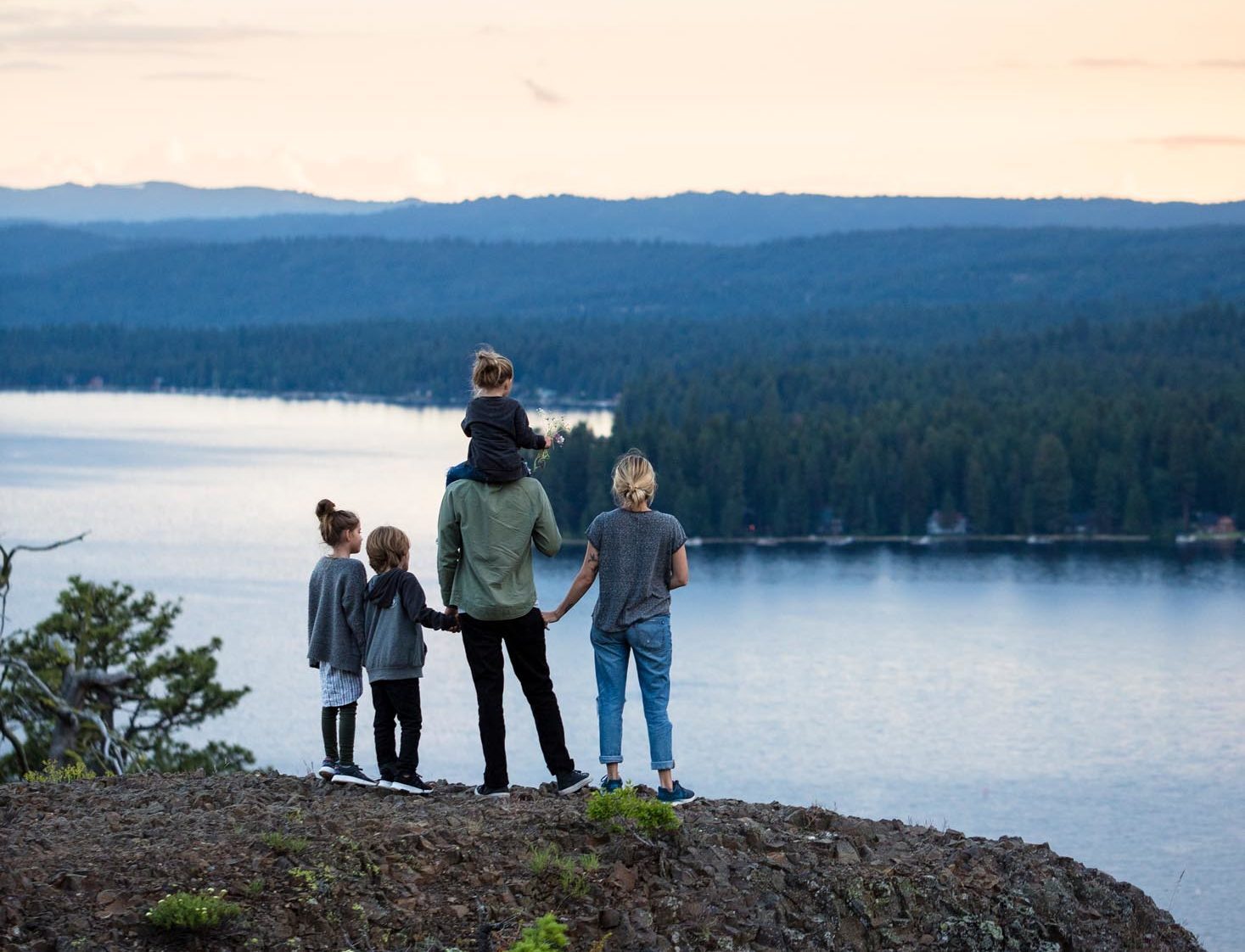
Photo Credit: Idaho Tourism
Who You Are
You love nature for its tranquility. Whether you’re meditating in the sun or gazing up at the Milky Way at night, you’re ready to disconnect from the hustle and bustle.
Where to Go
Cuddy Mountain Trail, Cambridge
This hike in the Hells Canyon Wilderness is secluded, peaceful, and relatively unknown. You’ll pass through pine forests and alpine meadows, without another person in sight. From the saddle you’ll catch unbelievable views of the Wallowas and Seven Devils Mountains.
Length: 7.5 mi.
Difficulty: Intermediate
Location: From Cambridge, head 17 miles north on Hwy 71. Turn right on National Forest Road 44 and continue for just under a mile. The trailhead is at Brownlee Campground.
When to go: Visit in June or July for balmy weather. Accessible June – November.
Peace Creek, Near Cascade
Here’s a hike that lives up to its name. Located deep in the Boise National Forest, this secluded hike meanders past creeks and majestic mountain views. In spring you’ll see meadows full of wild lupine and sticky geranium. In fall, you’ll be surrounded by dazzling fall colors.
Length: 5.6 mi.
Difficulty: Intermediate
Location: From Garden Valley, head north on the Banks-Lowman highway. Turn right on Middlefork Road, and right again on National Forest Road 671. Continue for 10 miles. The Peace Valley campground and trailhead will be on your right.
When to go: Visit in spring or fall. Accessible May – November.
Halverson Lake Trail, South of Melba
This hidden gem of a hike highlights the beauty of the Owyhee Desert. You’ll walk past ancient petroglyphs and see dozens of raptors soaring overhead. Halverson Lake is a tranquil oasis surrounded by volcanic cliffs. It’s the perfect spot to relax and daydream.
Length: 3.8 mi.
Difficulty: Easy
Location: From Melba, follow S. Can Ada Rd. south for 6 miles. Turn left on Victory Ln. You’ll reach the trailhead in about .7 mi.
When to go: Visit in April or May to see the desert at its prettiest. Accessible year round.
For The Artists
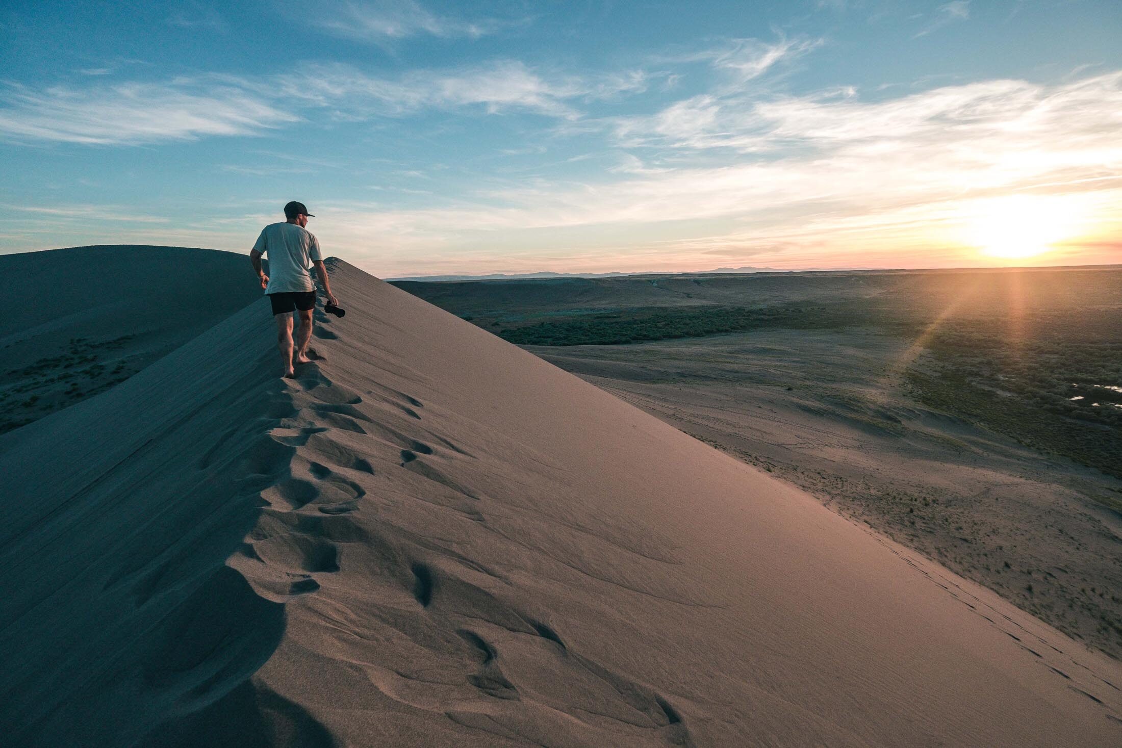
Photo Credit: Idaho Tourism
Who You Are
You’re an appreciator of the aesthetic. Whether it’s for your Insta feed or your eyes only, you’re always searching for the next great view. You want sweeping vistas and grand panoramas.
Where to Go
Avondale Basin Trail, Silver City
Silver City is a gold rush-era ghost town in the Owyhee Mountains. It’s a charming and slightly spooky old town that’s a must-see for visitors. And the surroundings are just as beautiful. The Avondale Basin Trail wanders through the forest, high desert landscape, and creeks.
Length: 4.3 mi.
Difficulty: Easy
Location: The trailhead is at an unnamed campground two miles south of Silver City, along Jordan Creek.
When to go: Visit in fall to catch the incredible autumn colors. Accessible June – September.
Bruneau Dunes Loop, Bruneau Dunes State Park
This gorgeous hike winds through a stunning desert oasis. Groves of narrowleaf willows give way to slippery sand dunes, and the view from the top of the dunes is breathtaking. Tricky footing and extreme conditions in the summer make this short hike a bit of a challenge, but it’s well worth the effort.
Length: 2.3 mi.
Difficulty: Intermediate
Location: The trailhead begins at the main parking lot, and loops around the lake.
When to go: Visit in April to see the desert spring to life. Accessible year-round.
Snowslide Lake Trail, McCall
There are many alpine lakes tucked into the mountains around McCall, but Snowslide Lake is one of the most beautiful. The trail is steep and there are several creeks to cross, but enterprising hikers will be rewarded with views unlike any in the world.
Length: 3.5 mi.
Difficulty: Intermediate
Location: From McCall, head 15 miles north on Lick Creek Road. The Snowslide & Maki Lake trailhead will be on a pullout to your right.
When to go: Visit in July or August, when it’s warm enough to take a dip in the lake. Accessible June – October.
local’s tip: Looking for a base camp? North Shore Lodge has everything you need, from cozy cabins and campfires to scenic views of Warm Lake.
For the Animal Lovers
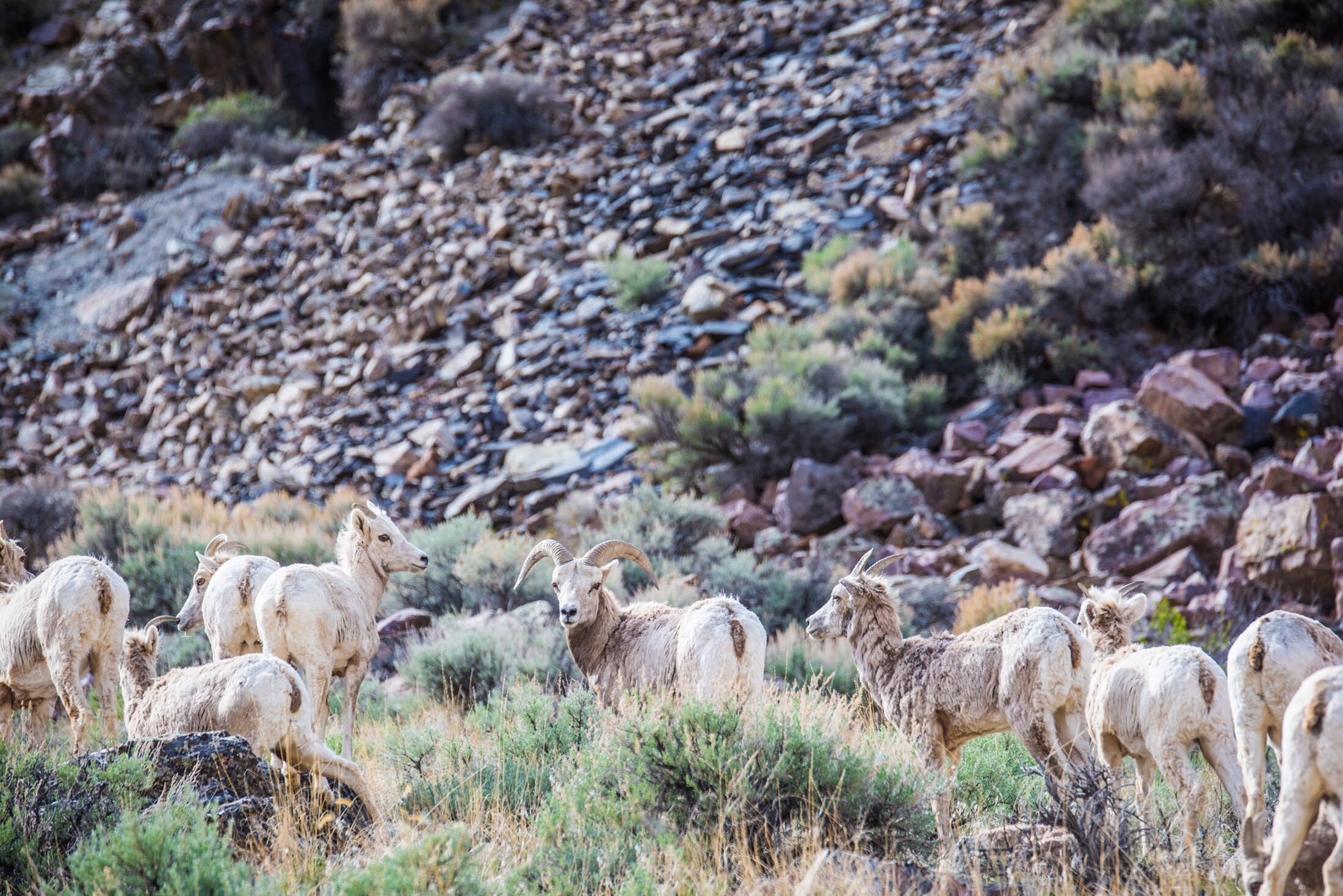
Photo Credit: Idaho Tourism
Who You Are
You want to see wildlife that’s just as wild as you. From mountain bluebirds to bighorn sheep, you’re ready to spot Idaho’s animals up close and personal.
Where to Go
Weiser River Trail, Weiser
The Weiser River Trail was once the Pacific and Idaho Northern Railroad. Now it’s a trail for hikers of all abilities. Walk a few miles for a fun day hike, or backpack all 84 miles. (If biking is more your thing, you can do that, too! Check out our bikepacking guide to learn more.) Either way, you’ll see tons of wildlife. Raptors, deer, elk, herons, waterfowl, and bears make the surrounding land their home.
Length: 84 mi. total
Difficulty: Easy
Location: The trail has 17 access points, including Weiser, Cambridge, Council, and Midvale.
When to go: Animals are often most active in spring and fall. Accessible year round.
Observation Hill Trail, Deer Flat National Wildlife Refuge
Deer Flat National Wildlife Refuge is host to millions of migratory birds year round. Depending on the time of year, you’ll spot geese, mallards, western grebes, owls, bald eagles, osprey, herons, and more. The trail loops around wetlands and features wildlife-viewing platforms.
Length: 3.25 mi.
Difficulty: Easy
Location: The Deer Flat Visitor Center is on the banks of Lake Lowell in Nampa.
When to go: Go anytime. Different species are plentiful all year.
Keep birdwatching while you relax on the waterfront patio of The Riverside Hotel.
Lily Marsh & Peninsula Trail Loop, Ponderosa State Park
Ponderosa State Park is on the shores of Payette Lake in McCall. While there are dozens of hiking trails that are all worth seeing, the Lily Marsh & Peninsula loop is something special. As you trek through pine forests and around a blooming lily pond, you’re likely to see waterfowl, frogs, raptors, deer, and even moose.
Length: 3 mi.
Difficulty: Easy
Location: Ponderosa State Park is about three miles north of downtown McCall. Park at the Aspen parking lot and follow signs for Peninsula Trail.
When to go: You’ll see the most wildlife in the late spring and early summer. Accessible April – November.
For The Hardcore
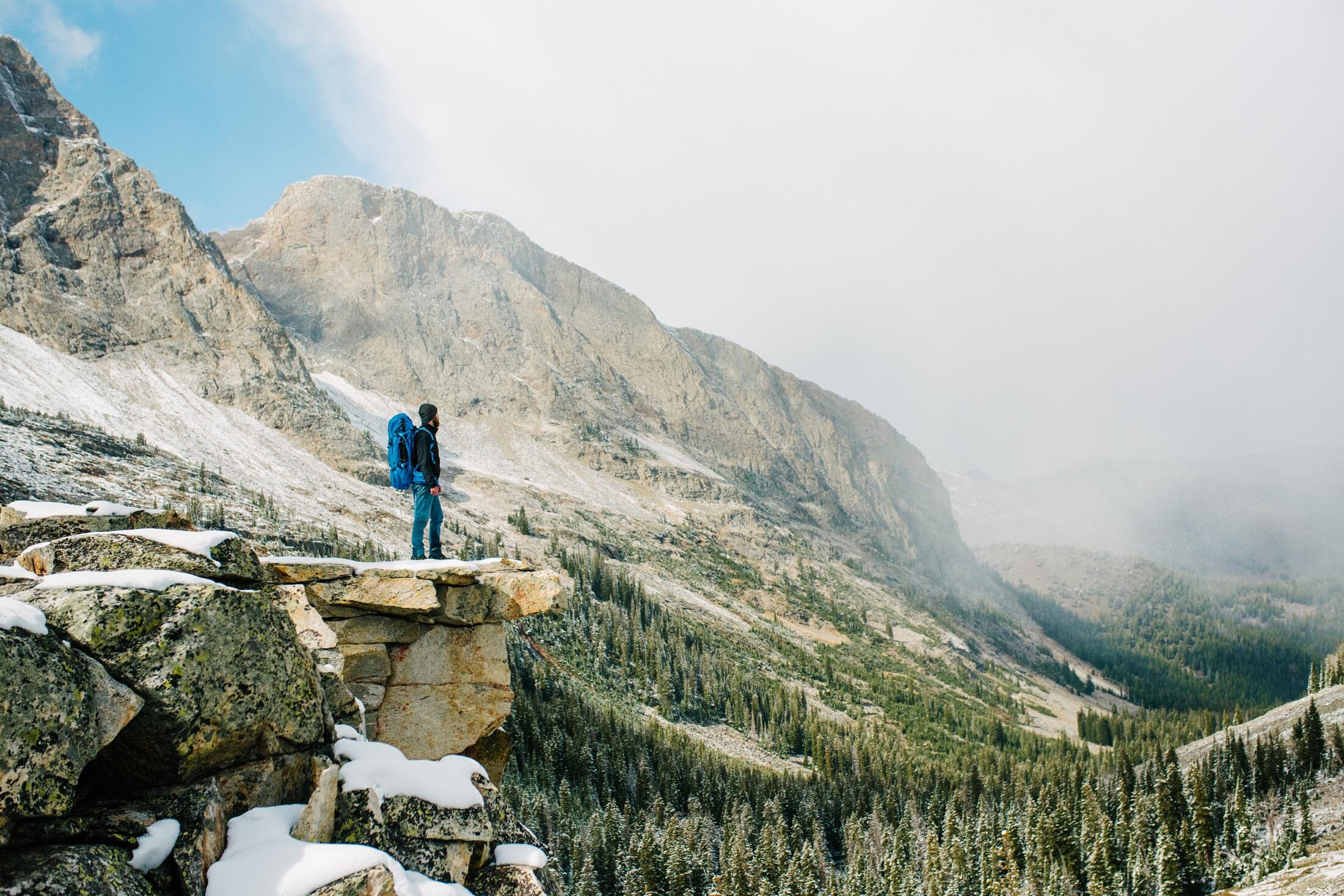
Photo Credit: Idaho Tourism
Who You Are
You’re no stranger to the wilderness. You’ve packed your tent, your water filter, and your well-worn boots. It’s time to hit the real backcountry — and Southwest Idaho backcountry is as wild as it comes.
Where to Go
Dry Creek Loop, Boise
Who knew there could be wilderness backpacking so close to the city? That’s Boise magic. Dry Creek Loop is a challenging trek with major elevation gain. You’ll begin in rolling sagebrush hills and continue to alpine meadows that stay snowy until early summer. There are four campgrounds on the loop, making it perfect for a three-day weekend trip.
Length: 13.8 mi.
Difficulty: Hard
Location: From Boise, go north on Bogus Basin Rd. for about 10 miles. The trailhead parking lot will be on your right, just after a series of switchbacks.
When to go: Visit in May or early June for the best weather. Accessible April – November.
local’s tip: There’s nothing like a little bit of luxury after you’ve been roughing it. Book a room at The Inn at 500 for some well-deserved pampering.
Loon Lake Loop, Boise
This mountain trail is popular with novice and experienced backpackers alike. Crossing the Secesh River, you’ll pass wildflowers, crystal clear waters, and famously, an old crashed B-23 bomber. Loon Lake is a serene spot to set up camp for the night and stargaze.
Length: 11.9 mi.
Difficulty: Hard
Location: From McCall, follow Warren Wagon Rd. 35 mi. north. Turn right onto National Forest Road 080. Continue for about a mile until you reach Chinook Campground.
When to go: Visit in early summer before fire season begins. Accessible April – October.
Wilson Creek Mini-Moab Loop, Melba
This Owyhee Mountain trail offers spectacular views of drastic desert landscape. You’ll be surrounded by towering red cliffs and the smell of sagebrush. Tricky uphill sections are interspersed with long flats. You’ll hear coyotes in the distance as you gather around the campfire in the evening.
Length: 11.7 mi.
Difficulty: Hard
Location: From Melba, follow ID-45 S. Turn right onto ID-78 in Walter’s Ferry. Continue for about 3 miles, then turn left onto Wilson Creek Rd. Continue for about 3 miles to the trailhead.
When to go: Visit in spring or fall to avoid extreme desert conditions. Accessible April – October.
Still haven’t gotten your fill of fresh air? Check out our guides to hidden hikes and exploring the Sawtooths.

